Lake Winnipeg Watershed Floor Map
The Lake Winnipeg watershed floor map was developed through a partnership between the Decolonizing Water project at the University of Ottawa and the Royal Canadian Geographical Society.
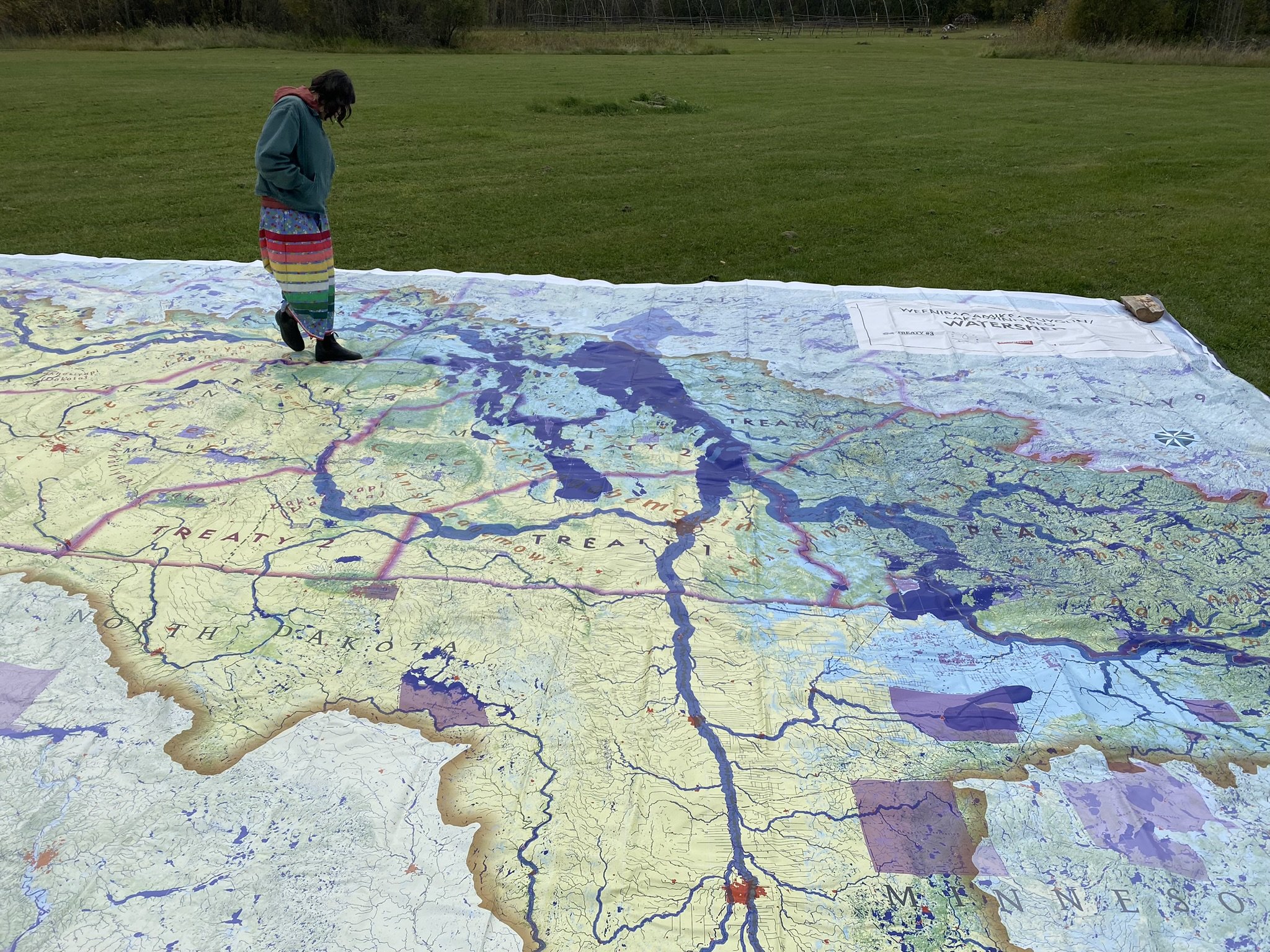
This watershed map is 9 by 12 meters, can comfortably stretch across half a school gym floor. With a map large enough to walk across, we intend to invite people into a conversation about connectedness and relationship building across the watershed and beyond. We want to use the map to explore the idea of a watershed treaty that would help govern relationships with and around the Lake Winnipeg watershed.
Joining the map project, the Territorial Planning Unit of Grand Council Treaty #3 provided data and advice in the production of the map. The caretaker of this map is the Lake Winnipeg Indigenous Collective, we are continuing to work in partnership with Decolonizing Water and the Royal Canadian Geographical Society to incorporate various forms of knowledge and community input.
The map was printed in a draft form intended to be refined based on input and feedback from various key stakeholders. An additional educational curriculum and opportunities for the map to travel will help enhance ongoing dialogues and relationship building.
If you would like to host the map at an event or provide suggestions, we’d love to hear from you.